Saturday, May 3, 2014

Erratics

As you travel the Calumet Region, you may see boulders.  I never really thought much about these boulders until I started my research about the glacial history of the Calumet Region.  First of all, these boulders have a name.  They are called erratics.  Erratics are "boulders that have been moved from their original location and found elsewhere, often scattered throughout moraines." Schoon, pg. 221
 
These huge rocks are native to Canada and upper Michigan.  They were carried here by glaciers during the recent ice age.  When the boulders were dragged by the glaciers they could have possibly created large striations, which are deep scratches in the bedrock underneath.  The scratches are usually parallel to the direction that the glacier had moved. Schoon, pgs. 13, 17
 
The large granite boulders are often found on till ("a mixture of clay, silt, sand, pebbles and boulders") and moraines ("a geographical feature composed of materials that were deposited by a glacier"). Schoon, pgs. 16, 221. When I needed to look for the erratics for my class, I wasn't sure exactly where I would find them in our area.  As it turns out, they are everywhere.  Residents of this area have moved them to their homes, their businesses and you can also find them at your local park.  While driving through my community, I did find erratics just about everywhere.  My neighbors across the street have a couple in front of their landscaping and my friend has some that border her driveway.  It's amazing to think that they were first brought here by glaciers!
 
References: Schoon J. Kenneth, Calumet Beginnings


The erratics shown above are located on the grounds
of the St. George Greek Orthodox Church in Schererville.
 
Photographs Taken By: Carol Haynes

Erratic in front of Stephen Park in Schererville.
 
Photograph Taken By: Carol Haynes

Erratics border a dentist's office in Schererville,  just south
of Route 30.
 
Photograph Taken By: Carol Haynes


Tolleston Shoreline/Gibson Woods

I grew up in Hammond and now work in the Hessville section of Hammond.  I find it interesting that part of the Tolleston Shoreline can be found near the Hess Cemetery at the intersection of 169th and Parrish.  When the Tolleston Shoreline was first created, the upper Great Lakes had three outlets.  There was the North Bay Outlet near Georgian Bay, the Port Huron Outlet past what is now Detroit, and the Chicago Outlet.  The North Bay Outlet raised higher than the two other outlets and then couldn't carry water out of the lakes.  Eventually erosion occured along the Port Huron Outlet, slowly lowering it and with it the level of Lakes Huron and Michigan so that the Chicago Outlet, having a floor of bedrock, became dry. Schoon, pg. 37.
 
During the Algoma phase about 3,800 years ago, the lake level dropped to its current level.  The lower water levels were created from erosion at Port Huron and dry weather conditions. The higher water levels were caused by intervals of greater rainfall.  This pattern created more than 150 small beach ridges.  Some of these beach ridges can still be seen in Miller and the Tolleston/Brunswick areas of Gary.  One of the longest dune ridges still remaining is in Hessville at Gibson Woods.  Schoon, pgs. 37, 38.  Gibson Woods "sits on 131 acres of virtually undisturbed land.  The dune and swale features of the preserve were produced after the last glacier created ancient Lake Chicago, the forerunner of Lake Michigan.  The parallel sand ridges still found in Gibson Woods today represent the effect of Lake Chicago as it retreated thousands of years ago." http://www.lakecountyparks.com/gibson.html
 
References: Schoon J. Kenneth, Calumet Beginnings
http://www.lakecountyparks.com/gibson.html

 
Part of the Tolleston Shoreline located at the intersection
of 169th St. and Parrish in Hammond.
 
Photograph Taken By: Carol Haynes
 

The Hess Cemetery is located by the Tolleston Shoreline
in Hessville.
 
Photograph Taken By: Carol Haynes
 

Gibson Woods is located on Parrish Ave. in Hessville.
 
Photograph Taken By: Carol Haynes
 

Gibson Woods Nature Preserve in Hessville.
 
Photograph Taken By: Carol Haynes


Glenwood Shoreline/Tinley Moraine

I have lived in Schererville for over thirty years and I am now just discovering that Schererville sits along the old Glenwood Shoreline.  A great deal of sand has been removed, so it is hard to see. 
When traveling, if you approach the intersection of Indianapolis Blvd. and Route 30, you can still see the shoreline if you are looking north.  South of the intersection is a hilly area that is part of the Tinley Moraine ("a geographical feature composed of materials that were deposited by a glacier.  Two common types of moraine are ground moraine and end moraine"). Schoon, pgs 180, 181, 221.  An end moraine is "a band of hills formed at the furthest extent of a glacial advance.  A glacier may form an end moraine each time it advances and retreats." Schoon, pg. 221.
 
During my travels, I stopped at Teibels Restaurant at the intersection of Routes 41 and 30.  I then took pictures north and south of the intersection. 

Teibels Restaurant sits on the corner of Route 41 and
Indianapolis Blvd.  This picture is looking south of
the intersection.
 
Photograph Taken By: Carol Haynes
 

Picture taken looking northbound from the intersection
of Route 30 and Indianapolis Blvd.
 
Photograph Taken By: Carol Haynes


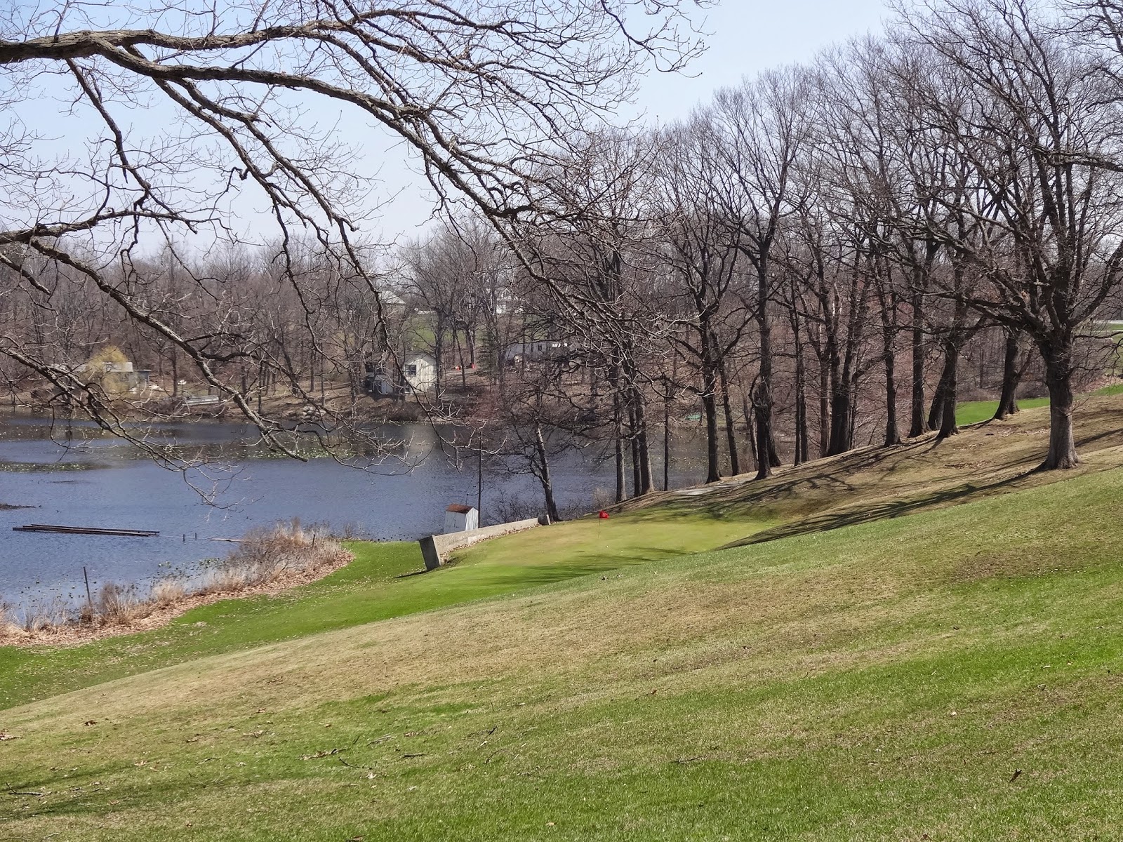
The Tinley Moraine ventures south to 231 Hwy.  I traveled on Route 41 and came to 231 Hwy which is close to Dick's Restaurant.  I took pictures at this intersection of Hwy 231, which runs east and west and then took pictures north and south of the Hwy.  There is also the Biesecker Prairie Nature Preserve that sits at the southeast corner of U.S. 231 and U.S. 41.  The prairie sits on 34 acres of land.  It is considered to be a small portion of the larger prairie that once covered western IN.  It is a grass prairie on top of rolling hills.  You can find little bluestem, Indian grass, prairie dock and rattlesnakes in the prairie.  Also rare and endangered plants such as flax, can also be found here.  http://www.historyandtheheadlines.abc-clio.com/

This is Hwy 231 which runs east and west.  The Biesecker
Prairie Nature Preserve is just south east of Hwy 231.
 
Photograph Taken By: Carol Haynes

Hwy 231 looking westward, just south of St. John.
 
Photograph Taken By: Carol Haynes

Biesecker Prairie Nature Preserve at the intersection
of Route 41 and Hwy 231
 
Photograph Taken By: Carol Haynes


I traveled back north to Route 30.  I then went west and headed down Route 30 to get more pictures of the Glenwood Shoreline.  I stopped by Meyers's Castle and took some photos there.  The Meyer's Castle is a replica of a Scottish castle.  It was completed in 1931. Back then, it was considered to be the most lavish mansion in the Calumet Region.  http://en.wikipedia.org/wiki/Meyer%27s-Castle.
 The castle sits atop a large dune.  "The sand dunes in the Dyer area were said to be 30-40 ft. high in the late 1930's.  Few of these exist today." Schoon, pg. 28.

Meyers Castle sits on the Glenwood Shoreline.
It is located on Route 30 in Dyer.
 
Photograph Taken By: Carol Haynes
Meyers Castle sits on an ancient sand dune.
 
Photograph Taken By: Carol Haynes


I then ventured farther west into Glenwood Illinois.  During the Glenwood Phase "lake currents and waves built up long spits, or sandy peninsulas on the down-current sides of these islands (Mt. Forest Island, Blue Island, and Glenwood Island in Cook County, Hobart Island in Lake county, and various small islands in Porter and LaPorte Counties in Indiana).   The Glenwood Spit, southeast of the original Glenwood Island (and along today's Glenwood Dyer Road) now forms one of the best visible portions of the Glenwood Shoreline."  Schoon, pg. 30.

Intersection of Glenwood Dyer Road
 
Photograph Taken By: Carol Haynes

Glenwood Dyer Road
Part of the Glenwood Shoreline
 
Photograph Taken By: Carol Haynes


I travel through these areas all the time, but I find it more fascinating now knowing the geological history of these areas.  I will certainly look at our landscapes in the Calumet Region now with a new respect. 
 
References: Schoon J. Kenneth, Calumet Beginnings,

Saturday, April 26, 2014

Our Future

Many people, including myself might be wondering what the future holds for our climate.  Is global warming worsening or are we moving into the next ice age?  First, we must look at the definitions of weather and climate to further understand this topic.  "Weather is what conditions of the atmosphere are, over a short period of time.  Climate is how the atmosphere "behaves" over relatively long periods of time." www.nasa.gov/mission_pages/hoaa.../climate/climate_weather.htm
 
If the weather during the winter of 2014 was an indication of the future, then I would say that we are moving into the next ice age.  The below zero temperatures combined with the amount of snow that many parts of the country experienced was phenomenal.  But this was our weather conditions over a short period of time.  We really need to look at the climate to predict what the future holds.  This is not going to be an easy task due to global warming.  The definition of global warming is "an unusually rapid increase in Earth's average surface temperature over the past century primarily due to greenhouse gases released by people burning fossil fuels." http://earthobservatory.nasa.gov/Features/GlobalWarming/
  
A mathematician named Milankovitch has an astronomical theory.  His theory of climate change is an explanation for changes in the seasons which result from changes in the earth's orbit around the sun. There is solar variable, eccentricity (shape of orbit), obliquity (tilt-which causes the seasons and the changes in the tilt of the earth change the strength of the seasons) and precession (wobble).  As the earth travels through space, three separate cycle movements combine to produce variations in the amount of solar energy falling.  It is believed that Milankovitch's theory does not allow the prediction of a "rapid" ice age onset.  Milankovitch's prediction is less than a century or two.  http://www.ncolc.noaa.gov/paleo/milankovitch.html
 
The greenhouse effect is worsening by the increased levels of carbon dioxide being countered by low-level clouds that are created by dust and other contaminants.  Scientists are having difficulty predicting what the overall climatic results will be as long as humans continue to pollute the earth, and global warming continues.  http://en.wikipedia.org/wiki/Global_cooling
 
A newspaper article states that "our own interglacial period has followed previous ones in having an abrupt beginning and a sharp peak, followed by slow cooling".  It states that there is question as to whether mankind's negative impact on the atmosphere has reversed the cooling course. 
 
I feel that at this time, the next ice age may be considered late coming.  Humankind's impact has had a significant change on our climate.  We need to be more conscious of how we lead our daily lives with respect to our environment.  If we continue to pollute our earth with greenhouse gases, the greenhouse concentration will continue to rise and the earth's surface temperature will continue to rise also.  If we can't control global warming, then the next ice age may be late. 
 
 
Greenhouse Effect


Melting Sea Ice
The Horrible Effects of Global Warming


Carbon Dioxide and other pollutants entering the atmosphere
causing the greenhouse effect.


Friday, April 18, 2014

Mink Lake is a kettle lake!

I wanted to visit a kettle lake in the Calumet Region.  A kettle lake is formed when large blocks of glacial ice close to the edge of a glacier break away from the main mass.  The blocks of ice are then buried by till or outwash (sand and gravel set down by the water from the melting glacier).  The block of ice that is buried eventually thaws and the sediment on top breaks down and a large hole will develop.  If the block of ice is rather large, than the hole will be larger.  The hole is filled with water and is then considered to be a kettle lake.  Kettle lakes are deep and are named after the black kettles with the rounded bottoms that the settlers had used.  (Schoon, pg. 23)
 
During my research of kettle lakes in the Calumet Region, I discovered that the Valparaiso Moraine has small kettle lakes upon it.  The Lake Michigan ice lobe deposited the Valparaiso moraine in a wide curve across far northwestern IN.  Along the moraine, the kettle lakes developed.  These water filled kettle shaped depressions are scattered along the moraine.  They were created by the melting of partially buried very large blocks of ice.  http://faculty.pnc.edu/pwilkin/geology.html  
 
Mink Lake is one of the kettle lakes on the Valparaiso Moraine.  It is located north of the Valparaiso city limits and west of Rt. 49.  I traveled there and found it located near the intersection of North Calumet Ave. and 632N/638N.  The lake is surrounded by a hilly golf course and a campground. 
Travelers can enjoy the golf course, fishing at the lake or staying at the campground.  There is also a bog (a small marsh) that you can visit called Hotter Lagoon next to Mink Lake.  http://www.valpolife.com
 
It is a pretty area to visit.  There are homes across the street from the lake, up on a hill.  Since studying about the glacial history in the Calumet Region, it makes me wonder if the neighbors there are aware of the lake's history.  It does give you a new found appreciation for our geology in the region.  When you think that this all started with the ice age and that it created such a beautiful landscape, it makes you feel very inspired!
 
References: Kenneth J. Schoon/Calumet Beginnings
 
Mink Lake which sits on the Valparaiso Moraine is
a kettle lake.
 
Photograph Taken By: Carol Haynes
 
 
Mink Lake is surrounded by a hilly golf course and
a campground.
 
Photograph Taken By: Carol Haynes
 
Ducks on the shoreline of Mink Lake.
 
Photograph Taken By: Carol Haynes
 
Mink Lake is off the intersection of 632N/638N/N. Calumet Ave.
Valparaiso, IN
 
Photograph Taken By: Carol Haynes


The Valparaiso Moraine

During my travels of the Calumet Region, I wanted to visit a moraine.  A moraine is "a geographical feature composed of materials that were deposited by a glacier". (Schoon pg. 221) In my class, Groundwater and Glaciers, I read about the Valparaiso Moraine. 
 
The moraine was created during the Pleistocene ice age, 1.8 million to 11,000 years ago.  The deposit or till contains small and large particles.  These particles can be clay, silt, sand, gravel pebbles and boulders.  When the ice age came to an end, the glaciers retreated north and vegetation started to develop.  (http://faculty.pnc.edu/pwilkin/geology.html/
 
The Valparaiso Moraine is about 60 miles long in Indiana and between 5 and 15 miles wide.  The Lake Michigan ice lobe set down the Valparaiso Moraine in a large curve across far northwestern Indiana. To the north, the moraine impounded a lake along the edge of the ice lobe, which was melting.  Mixed till and outwash were left from the meltwaters that had overflowed in places.  Kettle lakes ("a depression left where a block of ice, left behind in glacial sediments, finally melted") are also found in the region.  (Camp/Graham pg. 226, 296)
 
While researching the Valparaiso Moraine, I discovered an area that I could visit. 
I traveled east on Rt. 30 into Valparaiso.  I came to the intersection of N. Calumet Ave. and 632N/638N.  As I approached this area, I could see Mink Lake (which is a kettle lake) situated on part of the Valparaiso moraine.  A very hilly golf course rested around the lake.  As I stood and looked over the golf course and the lake, I was amazed that this was a part of the region's geological history. 
 
References: Kenneth J. Schoon/Calumet Beginnings
Mark J. Camp, Graham T. Richardson/Roadside Geology of Indiana


A part of the Valparaiso Moraine was used to create
a rolling hill golf course.
 
Photograph Taken By: Carol Haynes
 

A kettle lake called Mink Lake is located on the
Valparaiso Moraine.
 
Photograph Taken By: Carol Haynes

A campground sits on the Valparaiso Moraine across
from Mink Lake.
 
Photograph Taken By: Carol Haynes